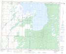
Maps showing Kettle Hills, 39-22,23-W, Manitoba
Kettle Hills is a Mountain located in 39-22,23-W, Manitoba and has an elevation of 338 meters.
- Latitude: 52° 19' 41'' North (decimal: 52.3281000)
- Longitude: 100° 37' 54'' West (decimal: -100.6316999)
- Topography Feature Category: Mountain
- Geographical Feature: Hills
- Canadian Province/Territory: Manitoba
- Elevation: 338 meters
- Location: 39-22,23-W
- Atlas of Canada Locator Map: Kettle Hills
- GPS Coordinate Locator Map: Kettle Hills Lat/Long