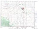
Maps showing Killarney Creek, 33-2-17-W, Manitoba
Killarney Creek is a River located in 33-2-17-W, Manitoba and has an elevation of 492 meters.
- Latitude: 49° 10' 41'' North (decimal: 49.1780999)
- Longitude: 99° 41' 42'' West (decimal: -99.6949999)
- Topography Feature Category: River
- Geographical Feature: Creek
- Canadian Province/Territory: Manitoba
- Elevation: 492 meters
- Location: 33-2-17-W
- Atlas of Canada Locator Map: Killarney Creek
- GPS Coordinate Locator Map: Killarney Creek Lat/Long