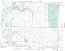
Maps showing Kingdon Lake, 16,17-23-26-W, Manitoba
Kingdon Lake is a Lake located in 16,17-23-26-W, Manitoba and has an elevation of 654 meters.
- Latitude: 50° 58' 57'' North (decimal: 50.9825000)
- Longitude: 101° 4' 5'' West (decimal: -101.0680999)
- Topography Feature Category: Lake
- Geographical Feature: Lake
- Canadian Province/Territory: Manitoba
- Elevation: 654 meters
- Location: 16,17-23-26-W
- Atlas of Canada Locator Map: Kingdon Lake
- GPS Coordinate Locator Map: Kingdon Lake Lat/Long
Kingdon Lake NTS Map Sheets