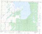
Maps showing Kirk Creek, Manitoba
Kirk Creek is a River located in Manitoba and has an elevation of 271 meters.
- Latitude: 52° 27' 32'' North (decimal: 52.4588999)
- Longitude: 100° 46' 40'' West (decimal: -100.7778000)
- Topography Feature Category: River
- Geographical Feature: Creek
- Canadian Province/Territory: Manitoba
- Elevation: 271 meters
- GPS Coordinate Locator Map: Kirk Creek Lat/Long