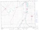
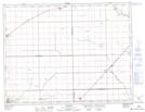
Maps showing Kosc Coulee, 17-8-1-E, Manitoba
Kosc Coulee is a Valley located in 17-8-1-E, Manitoba and has an elevation of 240 meters.
- Latitude: 49° 39' 21'' North (decimal: 49.6557999)
- Longitude: 97° 24' 52'' West (decimal: -97.4143999)
- Topography Feature Category: Valley
- Geographical Feature: Coulee
- Canadian Province/Territory: Manitoba
- Elevation: 240 meters
- Location: 17-8-1-E
- Atlas of Canada Locator Map: Kosc Coulee
- GPS Coordinate Locator Map: Kosc Coulee Lat/Long
Kosc Coulee NTS Map Sheets