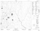
Maps showing Lagimodiere Lake, 70-14-W, Manitoba
Lagimodiere Lake is a Lake located in 70-14-W, Manitoba.
- Latitude: 55° 2' 29'' North (decimal: 55.0413999)
- Longitude: 99° 29' 44'' West (decimal: -99.4956000)
- Topography Feature Category: Lake
- Geographical Feature: Lake
- Canadian Province/Territory: Manitoba
- Location: 70-14-W
- GPS Coordinate Locator Map: Lagimodiere Lake Lat/Long
Lagimodiere Lake NTS Map Sheets