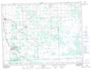
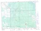
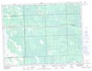
Maps showing Coteau Lamirande, 4,5-7,8-E, Manitoba
Coteau Lamirande is a Cliff located in 4,5-7,8-E, Manitoba and has an elevation of 304 meters.
- Latitude: 49° 21' 6'' North (decimal: 49.3516999)
- Longitude: 96° 31' 30'' West (decimal: -96.5249999)
- Topography Feature Category: Cliff
- Geographical Feature: Coteau
- Canadian Province/Territory: Manitoba
- Elevation: 304 meters
- Location: 4,5-7,8-E
- Atlas of Canada Locator Map: Coteau Lamirande
- GPS Coordinate Locator Map: Coteau Lamirande Lat/Long
Coteau Lamirande NTS Map Sheets