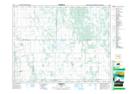
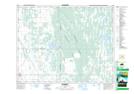
Maps showing Lanbourne Ridge, 21-22-13-W, Manitoba
Lanbourne Ridge is a Mountain located in 21-22-13-W, Manitoba.
- Latitude: 50° 51' 24'' North (decimal: 50.8566999)
- Longitude: 99° 10' 40'' West (decimal: -99.1778000)
- Topography Feature Category: Mountain
- Geographical Feature: Ridge
- Canadian Province/Territory: Manitoba
- Location: 21-22-13-W
- Atlas of Canada Locator Map: Lanbourne Ridge
- GPS Coordinate Locator Map: Lanbourne Ridge Lat/Long
Lanbourne Ridge NTS Map Sheets