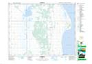
Maps showing Langruth Wildlife Management Area, 17-10-W, Manitoba
Langruth Wildlife Management Area is a Conservation area located in 17-10-W, Manitoba.
- Latitude: 50° 26' 50'' North (decimal: 50.4471999)
- Longitude: 98° 44' 29'' West (decimal: -98.7413999)
- Topography Feature Category: Conservation area
- Geographical Feature: Wildlife Management Area
- Canadian Province/Territory: Manitoba
- Location: 17-10-W
- Atlas of Canada Locator Map: Langruth Wildlife Management Area
- GPS Coordinate Locator Map: Langruth Wildlife Management Area Lat/Long