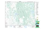
Maps showing Last Lake, 3,10,15,22-22-12-W, Manitoba
Last Lake is a Lake located in 3,10,15,22-22-12-W, Manitoba.
- Latitude: 50° 53' 18'' North (decimal: 50.8882999)
- Longitude: 99° 2' 40'' West (decimal: -99.0443999)
- Topography Feature Category: Lake
- Geographical Feature: Lake
- Canadian Province/Territory: Manitoba
- Location: 3,10,15,22-22-12-W
- Atlas of Canada Locator Map: Last Lake
- GPS Coordinate Locator Map: Last Lake Lat/Long