Canada Topographic Maps

Last Rapids Lake Topo Maps

Topography maps and Latitude/Longitude Location

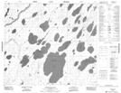
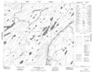
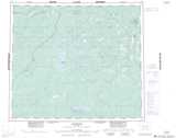
Maps showing Last Rapids Lake, Manitoba

Last Rapids Lake is a Lake located in Manitoba.

  • Latitude: 55° 42' 43'' North   (decimal: 55.7119000)
  • Longitude: 93° 29' 50'' West   (decimal: -93.4972000)
  • Topography Feature Category: Lake
  • Geographical Feature: Lake
  • Canadian Province/Territory: Manitoba
  • GPS Coordinate Locator Map: Last Rapids Lake Lat/Long

Last Rapids Lake NTS Map Sheets

053N11 Michiskan Lake Topographic Map at 1:50,000 scale

053N12 Kinosewkenaw Lake Topographic Map at 1:50,000 scale

053N Gods River Topographic Map at 1:250,000 scale

 
Buy Topographic Maps DVD
Newsletter Sign-up

Yes, I want to receive map store discounts.


Bookmark and Share