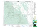
Maps showing Laurier Drain, 23-22-16-W, Manitoba
Laurier Drain is a Hydraulic construction located in 23-22-16-W, Manitoba.
- Latitude: 50° 55' 8'' North (decimal: 50.9189000)
- Longitude: 99° 36' 3'' West (decimal: -99.6007999)
- Topography Feature Category: Hydraulic construction
- Geographical Feature: Drain
- Canadian Province/Territory: Manitoba
- Location: 23-22-16-W
- Atlas of Canada Locator Map: Laurier Drain
- GPS Coordinate Locator Map: Laurier Drain Lat/Long