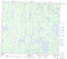
Maps showing Laurie River, Manitoba
Laurie River is a Unincorporated area located in Manitoba and has an elevation of 284 meters.
- Latitude: 56° 13' 32'' North (decimal: 56.2255999)
- Longitude: 101° 0' 25'' West (decimal: -101.0069000)
- Topography Feature Category: Unincorporated area
- Geographical Feature: Community
- Canadian Province/Territory: Manitoba
- Elevation: 284 meters
- Atlas of Canada Locator Map: Laurie River
- GPS Coordinate Locator Map: Laurie River Lat/Long
Laurie River NTS Map Sheets