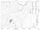
Maps showing Leaf Rapids, 1-75-12-W, Manitoba
Leaf Rapids is a Rapids located in 1-75-12-W, Manitoba and has an elevation of 254 meters.
- Latitude: 55° 28' 22'' North (decimal: 55.4728000)
- Longitude: 99° 11' 31'' West (decimal: -99.1919000)
- Topography Feature Category: Rapids
- Geographical Feature: Rapids
- Canadian Province/Territory: Manitoba
- Elevation: 254 meters
- Location: 1-75-12-W
- Atlas of Canada Locator Map: Leaf Rapids
- GPS Coordinate Locator Map: Leaf Rapids Lat/Long
Leaf Rapids NTS Map Sheets