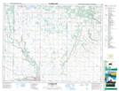
Maps showing Leda Lake, 32-17-18-W, Manitoba
Leda Lake is a Lake located in 32-17-18-W, Manitoba and has an elevation of 613 meters.
- Latitude: 50° 30' 00'' North (decimal: 50.4999999)
- Longitude: 99° 55' 25'' West (decimal: -99.9235999)
- Topography Feature Category: Lake
- Geographical Feature: Lake
- Canadian Province/Territory: Manitoba
- Elevation: 613 meters
- Location: 32-17-18-W
- Atlas of Canada Locator Map: Leda Lake
- GPS Coordinate Locator Map: Leda Lake Lat/Long
Leda Lake NTS Map Sheets