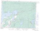
Maps showing Lee River, 36-16-12-E, Manitoba
Lee River is a River located in 36-16-12-E, Manitoba and has an elevation of 259 meters.
- Latitude: 50° 22' 59'' North (decimal: 50.3831000)
- Longitude: 95° 49' 38'' West (decimal: -95.8272000)
- Topography Feature Category: River
- Geographical Feature: River
- Canadian Province/Territory: Manitoba
- Elevation: 259 meters
- Location: 36-16-12-E
- Atlas of Canada Locator Map: Lee River
- GPS Coordinate Locator Map: Lee River Lat/Long
Lee River NTS Map Sheets