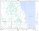
Maps showing Leifur, 23,26-20-10-W, Manitoba
Leifur is a Unincorporated area located in 23,26-20-10-W, Manitoba and has an elevation of 255 meters.
- Latitude: 50° 44' 35'' North (decimal: 50.7431000)
- Longitude: 98° 45' 52'' West (decimal: -98.7643999)
- Topography Feature Category: Unincorporated area
- Geographical Feature: Locality
- Canadian Province/Territory: Manitoba
- Elevation: 255 meters
- Location: 23,26-20-10-W
- Atlas of Canada Locator Map: Leifur
- GPS Coordinate Locator Map: Leifur Lat/Long