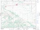
Maps showing Lelant, 25-10-9-W, Manitoba
Lelant is a Unincorporated area located in 25-10-9-W, Manitoba.
- Latitude: 49° 52' North (decimal: 49.8666999)
- Longitude: 98° 34' West (decimal: -98.5666999)
- Topography Feature Category: Unincorporated area
- Geographical Feature: Station
- Canadian Province/Territory: Manitoba
- Location: 25-10-9-W
- GPS Coordinate Locator Map: Lelant Lat/Long