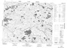
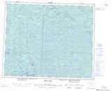
Maps showing Lewis Lake, 41-12,13-E, Manitoba
Lewis Lake is a Lake located in 41-12,13-E, Manitoba and has an elevation of 283 meters.
- Latitude: 52° 33' 54'' North (decimal: 52.5649999)
- Longitude: 95° 44' 38'' West (decimal: -95.7439000)
- Topography Feature Category: Lake
- Geographical Feature: Lake
- Canadian Province/Territory: Manitoba
- Elevation: 283 meters
- Location: 41-12,13-E
- Atlas of Canada Locator Map: Lewis Lake
- GPS Coordinate Locator Map: Lewis Lake Lat/Long
Lewis Lake NTS Map Sheets