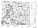
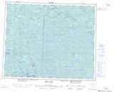
Maps showing Little Grand Rapids, 35-14-E, Manitoba
Little Grand Rapids is a Unincorporated area located in 35-14-E, Manitoba.
- Latitude: 52° 2' 10'' North (decimal: 52.0361000)
- Longitude: 95° 27' 40'' West (decimal: -95.4611000)
- Topography Feature Category: Unincorporated area
- Geographical Feature: Northern Community
- Canadian Province/Territory: Manitoba
- Location: 35-14-E
- Atlas of Canada Locator Map: Little Grand Rapids
- GPS Coordinate Locator Map: Little Grand Rapids Lat/Long
Little Grand Rapids NTS Map Sheets