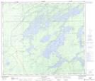
Maps showing Little Manitou Rapids, 67-12-5-W, Manitoba
Little Manitou Rapids is a Rapids located in 67-12-5-W, Manitoba and has an elevation of 202 meters.
- Latitude: 54° 47' 43'' North (decimal: 54.7952999)
- Longitude: 98° 4' 53'' West (decimal: -98.0814000)
- Topography Feature Category: Rapids
- Geographical Feature: Rapids
- Canadian Province/Territory: Manitoba
- Elevation: 202 meters
- Location: 67-12-5-W
- Atlas of Canada Locator Map: Little Manitou Rapids
- GPS Coordinate Locator Map: Little Manitou Rapids Lat/Long
Little Manitou Rapids NTS Map Sheets