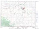
Maps showing Little Pembina River, 10-3-18-W, Manitoba
Little Pembina River is a River located in 10-3-18-W, Manitoba and has an elevation of 501 meters.
- Latitude: 49° 11' 40'' North (decimal: 49.1943999)
- Longitude: 99° 48' 59'' West (decimal: -99.8163999)
- Topography Feature Category: River
- Geographical Feature: River
- Canadian Province/Territory: Manitoba
- Elevation: 501 meters
- Location: 10-3-18-W
- Atlas of Canada Locator Map: Little Pembina River
- GPS Coordinate Locator Map: Little Pembina River Lat/Long