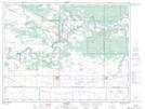
Maps showing Little Round Apple, 20,29-8-14-W, Manitoba
Little Round Apple is a Mountain located in 20,29-8-14-W, Manitoba and has an elevation of 369 meters.
- Latitude: 49° 40' 46'' North (decimal: 49.6794000)
- Longitude: 99° 19' 29'' West (decimal: -99.3246999)
- Topography Feature Category: Mountain
- Geographical Feature: Hill
- Canadian Province/Territory: Manitoba
- Elevation: 369 meters
- Location: 20,29-8-14-W
- Atlas of Canada Locator Map: Little Round Apple
- GPS Coordinate Locator Map: Little Round Apple Lat/Long