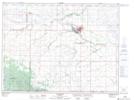
Maps showing Little Thompson Lake, 4-1-18-W, Manitoba
Little Thompson Lake is a Lake located in 4-1-18-W, Manitoba and has an elevation of 616 meters.
- Latitude: 49° 0' 7'' North (decimal: 49.0018999)
- Longitude: 99° 49' 39'' West (decimal: -99.8275000)
- Topography Feature Category: Lake
- Geographical Feature: Lake
- Canadian Province/Territory: Manitoba
- Elevation: 616 meters
- Location: 4-1-18-W
- Atlas of Canada Locator Map: Little Thompson Lake
- GPS Coordinate Locator Map: Little Thompson Lake Lat/Long