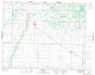
Maps showing Lizard Point Indian Reserve 62, Manitoba
Lizard Point Indian Reserve 62 is a Indian Reserve located in Manitoba.
- Latitude: 50° 40' 50'' North (decimal: 50.6806000)
- Longitude: 100° 55' 58'' West (decimal: -100.9328000)
- Topography Feature Category: Indian Reserve
- Geographical Feature: Indian Reserve
- Canadian Province/Territory: Manitoba
- GPS Coordinate Locator Map: Lizard Point Indian Reserve 62 Lat/Long
Lizard Point Indian Reserve 62 NTS Map Sheets