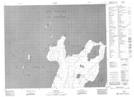
Maps showing Lynx Harbour, Manitoba
Lynx Harbour is a Bay located in Manitoba and has an elevation of 222 meters.
- Latitude: 52° 7' 5'' North (decimal: 52.1180999)
- Longitude: 97° 36' 38'' West (decimal: -97.6105999)
- Topography Feature Category: Bay
- Geographical Feature: Harbour
- Canadian Province/Territory: Manitoba
- Elevation: 222 meters
- Atlas of Canada Locator Map: Lynx Harbour
- GPS Coordinate Locator Map: Lynx Harbour Lat/Long
Lynx Harbour NTS Map Sheets