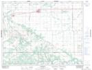
Maps showing MacGregor, 33-11-10-W, Manitoba
MacGregor is a Village located in 33-11-10-W, Manitoba and has an elevation of 290 meters.
- Latitude: 49° 57' 58'' North (decimal: 49.9660999)
- Longitude: 98° 46' 43'' West (decimal: -98.7786000)
- Topography Feature Category: Village
- Geographical Feature: Village
- Canadian Province/Territory: Manitoba
- Elevation: 290 meters
- Location: 33-11-10-W
- Atlas of Canada Locator Map: MacGregor
- GPS Coordinate Locator Map: MacGregor Lat/Long