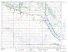
Maps showing Manhattan Beach, 8-5-16-W, Manitoba
Manhattan Beach is a Unincorporated area located in 8-5-16-W, Manitoba and has an elevation of 416 meters.
- Latitude: 49° 22' 51'' North (decimal: 49.3807999)
- Longitude: 99° 35' 30'' West (decimal: -99.5916999)
- Topography Feature Category: Unincorporated area
- Geographical Feature: Locality
- Canadian Province/Territory: Manitoba
- Elevation: 416 meters
- Location: 8-5-16-W
- Atlas of Canada Locator Map: Manhattan Beach
- GPS Coordinate Locator Map: Manhattan Beach Lat/Long