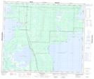
Maps showing Margie Island, Manitoba
Margie Island is a Island located in Manitoba and has an elevation of 271 meters.
- Latitude: 54° 9' 2'' North (decimal: 54.1506000)
- Longitude: 101° 26' 23'' West (decimal: -101.4397000)
- Topography Feature Category: Island
- Geographical Feature: Island
- Canadian Province/Territory: Manitoba
- Elevation: 271 meters
- Atlas of Canada Locator Map: Margie Island
- GPS Coordinate Locator Map: Margie Island Lat/Long
Margie Island NTS Map Sheets