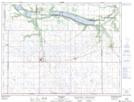
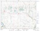
Maps showing Marringhurst Creek, 27-3-12-W, Manitoba
Marringhurst Creek is a River located in 27-3-12-W, Manitoba and has an elevation of 451 meters.
- Latitude: 49° 14' 42'' North (decimal: 49.2450000)
- Longitude: 99° 0' 37'' West (decimal: -99.0102999)
- Topography Feature Category: River
- Geographical Feature: Creek
- Canadian Province/Territory: Manitoba
- Elevation: 451 meters
- Location: 27-3-12-W
- Atlas of Canada Locator Map: Marringhurst Creek
- GPS Coordinate Locator Map: Marringhurst Creek Lat/Long
Marringhurst Creek NTS Map Sheets