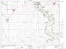
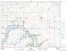
Maps showing Mary Jane Creek, 19-3-9-W, Manitoba
Mary Jane Creek is a River located in 19-3-9-W, Manitoba and has an elevation of 477 meters.
- Latitude: 49° 13' 50'' North (decimal: 49.2306000)
- Longitude: 98° 40' 33'' West (decimal: -98.6757999)
- Topography Feature Category: River
- Geographical Feature: Creek
- Canadian Province/Territory: Manitoba
- Elevation: 477 meters
- Location: 19-3-9-W
- Atlas of Canada Locator Map: Mary Jane Creek
- GPS Coordinate Locator Map: Mary Jane Creek Lat/Long
Mary Jane Creek NTS Map Sheets