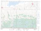
Maps showing Matts Lake, 20-2-21-W, Manitoba
Matts Lake is a Lake located in 20-2-21-W, Manitoba and has an elevation of 571 meters.
- Latitude: 49° 8' 38'' North (decimal: 49.1439000)
- Longitude: 100° 15' 22'' West (decimal: -100.2560999)
- Topography Feature Category: Lake
- Geographical Feature: Lake
- Canadian Province/Territory: Manitoba
- Elevation: 571 meters
- Location: 20-2-21-W
- Atlas of Canada Locator Map: Matts Lake
- GPS Coordinate Locator Map: Matts Lake Lat/Long