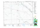
Maps showing Maxwell Oxbow, Manitoba
Maxwell Oxbow is a Lake located in Manitoba and has an elevation of 241 meters.
- Latitude: 49° 56' 52'' North (decimal: 49.9477999)
- Longitude: 97° 37' 57'' West (decimal: -97.6324999)
- Topography Feature Category: Lake
- Geographical Feature: Lake
- Canadian Province/Territory: Manitoba
- Elevation: 241 meters
- Atlas of Canada Locator Map: Maxwell Oxbow
- GPS Coordinate Locator Map: Maxwell Oxbow Lat/Long