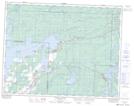
Maps showing McArthur Falls, 3-17-11-E, Manitoba
McArthur Falls is a Unincorporated area located in 3-17-11-E, Manitoba.
- Latitude: 50° 23' 52'' North (decimal: 50.3977999)
- Longitude: 95° 59' 47'' West (decimal: -95.9964000)
- Topography Feature Category: Unincorporated area
- Geographical Feature: Locality
- Canadian Province/Territory: Manitoba
- Location: 3-17-11-E
- Atlas of Canada Locator Map: McArthur Falls
- GPS Coordinate Locator Map: McArthur Falls Lat/Long
McArthur Falls NTS Map Sheets