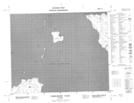
Maps showing McBeth Reef, Manitoba
McBeth Reef is a Shoal located in Manitoba.
- Latitude: 52° 10' North (decimal: 52.1667000)
- Longitude: 97° 29' West (decimal: -97.4833000)
- Topography Feature Category: Shoal
- Geographical Feature: Reef
- Canadian Province/Territory: Manitoba
- Atlas of Canada Locator Map: McBeth Reef
- GPS Coordinate Locator Map: McBeth Reef Lat/Long
McBeth Reef NTS Map Sheets