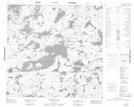
Maps showing McCallum Peninsula, Manitoba
McCallum Peninsula is a Cape located in Manitoba and has an elevation of 287 meters.
- Latitude: 58° 49' 48'' North (decimal: 58.8300000)
- Longitude: 99° 51' 50'' West (decimal: -99.8638999)
- Topography Feature Category: Cape
- Geographical Feature: Peninsula
- Canadian Province/Territory: Manitoba
- Elevation: 287 meters
- Atlas of Canada Locator Map: McCallum Peninsula
- GPS Coordinate Locator Map: McCallum Peninsula Lat/Long
McCallum Peninsula NTS Map Sheets