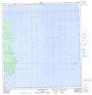
Maps showing McCreary Island, Manitoba
McCreary Island is a Island located in Manitoba.
- Latitude: 52° 15' 51'' North (decimal: 52.2642000)
- Longitude: 97° 44' 49'' West (decimal: -97.7469000)
- Topography Feature Category: Island
- Geographical Feature: Island
- Canadian Province/Territory: Manitoba
- GPS Coordinate Locator Map: McCreary Island Lat/Long
McCreary Island NTS Map Sheets