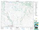
Maps showing McFadden Valley, 17,18-16-W, Manitoba
McFadden Valley is a Valley located in 17,18-16-W, Manitoba and has an elevation of 637 meters.
- Latitude: 50° 30' 34'' North (decimal: 50.5094000)
- Longitude: 99° 36' 37'' West (decimal: -99.6103000)
- Topography Feature Category: Valley
- Geographical Feature: Valley
- Canadian Province/Territory: Manitoba
- Elevation: 637 meters
- Location: 17,18-16-W
- Atlas of Canada Locator Map: McFadden Valley
- GPS Coordinate Locator Map: McFadden Valley Lat/Long
McFadden Valley NTS Map Sheets