Canada Topographic Maps

McGillis Creek Topo Maps

Topography maps and Latitude/Longitude Location

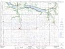
Maps showing McGillis Creek, Manitoba

McGillis Creek is a River located in Manitoba.

  • Latitude: 49° 5' 33'' North   (decimal: 49.0925000)
  • Longitude: 99° 19' 17'' West   (decimal: -99.3214000)
  • Topography Feature Category: River
  • Geographical Feature: Creek
  • Canadian Province/Territory: Manitoba
  • GPS Coordinate Locator Map: McGillis Creek Lat/Long

McGillis Creek NTS Map Sheets

062G03 Holmfield Topographic Map at 1:50,000 scale

062G Brandon Topographic Map at 1:250,000 scale

 
Buy Topographic Maps DVD
Newsletter Sign-up

Yes, I want to receive map store discounts.


Bookmark and Share