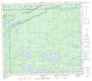
Maps showing McKillop Lake, 80-1-E, Manitoba
McKillop Lake is a Lake located in 80-1-E, Manitoba and has an elevation of 186 meters.
- Latitude: 55° 54' 35'' North (decimal: 55.9096999)
- Longitude: 97° 24' 34'' West (decimal: -97.4093999)
- Topography Feature Category: Lake
- Geographical Feature: Lake
- Canadian Province/Territory: Manitoba
- Elevation: 186 meters
- Location: 80-1-E
- Atlas of Canada Locator Map: McKillop Lake
- GPS Coordinate Locator Map: McKillop Lake Lat/Long