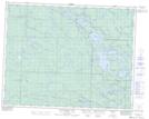
Maps showing McRorie Lake, 21-13-E, Manitoba
McRorie Lake is a Lake located in 21-13-E, Manitoba and has an elevation of 301 meters.
- Latitude: 50° 45' 55'' North (decimal: 50.7653000)
- Longitude: 95° 41' 19'' West (decimal: -95.6885999)
- Topography Feature Category: Lake
- Geographical Feature: Lake
- Canadian Province/Territory: Manitoba
- Elevation: 301 meters
- Location: 21-13-E
- Atlas of Canada Locator Map: McRorie Lake
- GPS Coordinate Locator Map: McRorie Lake Lat/Long
McRorie Lake NTS Map Sheets