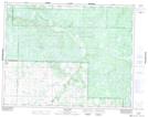
Maps showing McTavish Lake, 30-21-22-W, Manitoba
McTavish Lake is a Lake located in 30-21-22-W, Manitoba and has an elevation of 618 meters.
- Latitude: 50° 50' 18'' North (decimal: 50.8382999)
- Longitude: 100° 31' 11'' West (decimal: -100.5196999)
- Topography Feature Category: Lake
- Geographical Feature: Lake
- Canadian Province/Territory: Manitoba
- Elevation: 618 meters
- Location: 30-21-22-W
- Atlas of Canada Locator Map: McTavish Lake
- GPS Coordinate Locator Map: McTavish Lake Lat/Long
McTavish Lake NTS Map Sheets