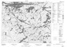
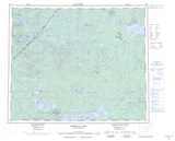
Maps showing Meegeesi River, Manitoba
Meegeesi River is a River located in Manitoba.
- Latitude: 53° 43' 28'' North (decimal: 53.7244000)
- Longitude: 93° 46' 42'' West (decimal: -93.7783000)
- Topography Feature Category: River
- Geographical Feature: River
- Canadian Province/Territory: Manitoba
- Atlas of Canada Locator Map: Meegeesi River
- GPS Coordinate Locator Map: Meegeesi River Lat/Long
Meegeesi River NTS Map Sheets