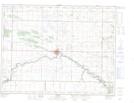
Maps showing Menteith, 7-7-22-W, Manitoba
Menteith is a Unincorporated area located in 7-7-22-W, Manitoba and has an elevation of 423 meters.
- Latitude: 49° 33' 32'' North (decimal: 49.5589000)
- Longitude: 100° 26' 34'' West (decimal: -100.4428000)
- Topography Feature Category: Unincorporated area
- Geographical Feature: Railway Point
- Canadian Province/Territory: Manitoba
- Elevation: 423 meters
- Location: 7-7-22-W
- Atlas of Canada Locator Map: Menteith
- GPS Coordinate Locator Map: Menteith Lat/Long