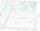
Maps showing Mickle Lake, 35-18-26-W, Manitoba
Mickle Lake is a Lake located in 35-18-26-W, Manitoba and has an elevation of 548 meters.
- Latitude: 50° 35' 29'' North (decimal: 50.5914000)
- Longitude: 100° 57' 30'' West (decimal: -100.9583000)
- Topography Feature Category: Lake
- Geographical Feature: Lake
- Canadian Province/Territory: Manitoba
- Elevation: 548 meters
- Location: 35-18-26-W
- Atlas of Canada Locator Map: Mickle Lake
- GPS Coordinate Locator Map: Mickle Lake Lat/Long
Mickle Lake NTS Map Sheets