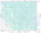
Maps showing Mill Ridge, 26,27,28,29-5W, Manitoba
Mill Ridge is a Mountain located in 26,27,28,29-5W, Manitoba and has an elevation of 275 meters.
- Latitude: 51° 23' 12'' North (decimal: 51.3866999)
- Longitude: 98° 8' 45'' West (decimal: -98.1458000)
- Topography Feature Category: Mountain
- Geographical Feature: Ridge
- Canadian Province/Territory: Manitoba
- Elevation: 275 meters
- Location: 26,27,28,29-5W
- Atlas of Canada Locator Map: Mill Ridge
- GPS Coordinate Locator Map: Mill Ridge Lat/Long
Mill Ridge NTS Map Sheets