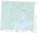
Maps showing Millwater, 3-65-28-W, Manitoba
Millwater is a Unincorporated area located in 3-65-28-W, Manitoba and has an elevation of 285 meters.
- Latitude: 54° 35' 33'' North (decimal: 54.5924999)
- Longitude: 101° 36' 52'' West (decimal: -101.6144000)
- Topography Feature Category: Unincorporated area
- Geographical Feature: Locality
- Canadian Province/Territory: Manitoba
- Elevation: 285 meters
- Location: 3-65-28-W
- Atlas of Canada Locator Map: Millwater
- GPS Coordinate Locator Map: Millwater Lat/Long
Millwater NTS Map Sheets