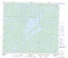
Maps showing Ministik Creek, 86,87-18-W, Manitoba
Ministik Creek is a River located in 86,87-18-W, Manitoba and has an elevation of 278 meters.
- Latitude: 56° 30' 9'' North (decimal: 56.5025000)
- Longitude: 100° 14' 7'' West (decimal: -100.2353000)
- Topography Feature Category: River
- Geographical Feature: Creek
- Canadian Province/Territory: Manitoba
- Elevation: 278 meters
- Location: 86,87-18-W
- Atlas of Canada Locator Map: Ministik Creek
- GPS Coordinate Locator Map: Ministik Creek Lat/Long
Ministik Creek NTS Map Sheets