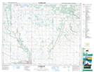
Maps showing Minnedosa Lake Wildlife Refuge, 15-17,18-W, Manitoba
Minnedosa Lake Wildlife Refuge is a Conservation area located in 15-17,18-W, Manitoba.
- Latitude: 50° 16' 37'' North (decimal: 50.2768999)
- Longitude: 99° 49' 34'' West (decimal: -99.8260999)
- Topography Feature Category: Conservation area
- Geographical Feature: Wildlife Refuge
- Canadian Province/Territory: Manitoba
- Location: 15-17,18-W
- Atlas of Canada Locator Map: Minnedosa Lake Wildlife Refuge
- GPS Coordinate Locator Map: Minnedosa Lake Wildlife Refuge Lat/Long
Minnedosa Lake Wildlife Refuge NTS Map Sheets