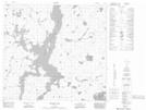
Maps showing Mistay Narrows, Manitoba
Mistay Narrows is a Channel located in Manitoba and has an elevation of 313 meters.
- Latitude: 57° 40' 42'' North (decimal: 57.6782999)
- Longitude: 99° 44' 57'' West (decimal: -99.7491999)
- Topography Feature Category: Channel
- Geographical Feature: Narrows
- Canadian Province/Territory: Manitoba
- Elevation: 313 meters
- Atlas of Canada Locator Map: Mistay Narrows
- GPS Coordinate Locator Map: Mistay Narrows Lat/Long
Mistay Narrows NTS Map Sheets